
Walk the Palm Beach County Street Directory
Begin with the exact street name in the Palm Beach County Property Appraiser's Public Access system, known as PAPA. A whole-street query does not require a house number. It produces parcel records in situs-address order, which makes it the strongest first pass for a street directory. Situs means the physical location of the land. The owner mailing address is where tax notices go and may be elsewhere.
- Enter the street name in PAPA Advanced Search. Leave the number blank, adding municipality or ZIP only when results are broad.
- Open each parcel. Save its 17-digit property control number, legal description, owner, mailing address, and deed book/page or instrument link.
- Use the parcel map or myGeoNav to confirm the street sequence and inspect nearby polygons.
- Carry the PCN, legal description, or book/page into the Clerk's deed index. These keys are safer than a name alone.
- Add lawful voter-file evidence, jurisdiction-correct permits, and a reverse directory only when the question calls for them.
This flow separates proof from inference. A deed supports title. A tax roll identifies the assessed owner. Homestead information may support an owner-occupancy inference, but it does not name every person in a home.
Palm Beach County Street Directory Search Fields
PAPA Advanced Search is built for more than one address. Its component controls let a researcher browse by street while keeping postal and municipal geography separate. Type slowly and select the predictive suggestion when pasted text fails.
| Search control | Street use | Format note |
|---|---|---|
| Street components | Number, prefix, name, suffix, direction, unit | Street Name alone returns a whole street |
| Owner Name | Narrow parcels tied to one owner | Last name first; partial values work |
| PCN | Return to one stable parcel | Dashed or undashed 17 digits |
| Municipality and ZIP | Resolve duplicate street names | Separate because postal city is not jurisdiction |
| Subdivision or condo | Limit a long road | Autocomplete control |
| Book/Page or legal | Connect assessment to title | Range, township, and section also available |
Results can include municipality, prior sales, deed references, values, exemptions, structures, and aerial links. The county reports 662,126 real parcels in 2026, so precise fields prevent false matches.
The PAPA street and sales screen displays these controls.
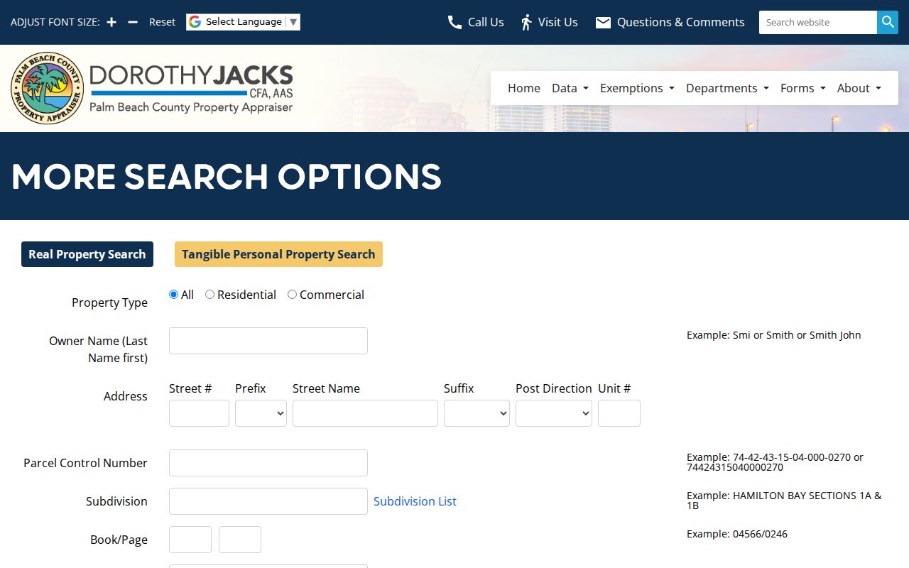
The screen shows why street, municipality, ZIP, and parcel criteria remain distinct choices.
Palm Beach County Street Directory Record Layers
No official file is a complete resident roll. A useful street directory chains address-keyed sources, each held by a different custodian and answering a narrower question.
| Address source | Keeper | Evidence | Access route |
|---|---|---|---|
| Parcel and tax roll | Property Appraiser | Owner, situs, mailing, PCN, legal, sales | Free PAPA portal and data |
| GIS parcel map | PAO and county GIS | Order, adjacency, aerial, districts | Free viewer |
| Official Records | Clerk | Deeds, liens, plats, legal description | Landmark; counter, mail, books, film |
| Permit and code | PZB or municipality | Work, applicants, status, violations | Portal, phone, email, certified search |
| Voter registration | Supervisor of Elections | Nonexempt registrants and history | Verification or records request |
| Reverse directories | Libraries and archives | Past occupant or business by address | Catalog, staff, digital, or in person |
The PCN and legal description join a parcel to deeds and plats. A street name joins permits and directory entries, but may fail after a rename or annexation.
Map Parcels in the Palm Beach County Street Directory
In myGeoNav, search a valid address, zoom to it, turn on the parcel layer, and click the target polygon. Pan down the block and click each adjoining shape. The selected PCN leads back to the assessment record. The PSAP layer helps identify service jurisdiction. The Neighborhood Dashboard adds precinct, district, municipality, schools, services, and road authority.
GIS is reference geography, not title proof. Parcel lines and nearby-sales tools help orient a street directory, but recorded instruments control ownership questions. County aerials are collected countywide in odd years, while the eastern county and three western municipalities are also flown in even years.
- Parcel
- A mapped unit of land with its own assessment record and PCN.
- Situs address
- The physical site, distinct from the owner's mailing address.
- Plat
- A recorded subdivision map showing lots, blocks, and streets.
- Criss-cross directory
- A historical directory arranged by street and number rather than only surname.
Follow Deeds From the Palm Beach County Street Directory
A parcel's sale panel may supply book/page or an instrument number. Enter it in the Clerk's Landmark Official Records search. Results can show party and role, document type, recording date, instrument number, book/page, legal description or PCN, consideration when captured, and an image.
Landmark also offers searches by name, document type, case number, consideration, parcel ID, date range, legal description, marriage, and abstract. A person searching by street should favor the parcel ID, book/page, instrument number, or legal fields already copied from PAPA. Name-only matches can mix people, and a physical address may be absent from an older instrument even when the legal description is clear. In the deed image, compare the grantor and grantee, return address, consideration, witnesses, notary, and full legal description with the index.
Official Records books begin in 1909. Online images begin January 1, 1968. Uncertified online images are free. For 1909 through 1967, use the Records Service Center in Room 4.2500 at 205 N. Dixie Highway, call 561-355-2932, email ORWEB@mypalmbeachclerk.com, or mail P.O. Box 4526, West Palm Beach, FL 33402-4526. State the exact name, time span, and legal facts. A Clerk search costs $2 per year per name or legal description; ordinary copies cost $1 per page.
Electronic certification costs $8 per document plus a 3.5 percent processing charge. Mail or counter certification adds $2 per instrument and a $1 authenticated cover to the copy cost. Certification proves that a copy came from the custodian; it does not resolve whether a person presently occupies the land. Plats and rights-of-way can reach into late-1800s material, which may help bridge a renamed road even though Palm Beach County's own Official Records books start later.
Before July 1909, test Dade County records. Early Palm Beach County books may also cover places later assigned to Broward, Okeechobee, or Martin counties.
Palm Beach County Street Directory Permits by Address
First decide whether a parcel lies in one of 39 municipalities or unincorporated Palm Beach County. A West Palm Beach postal label does not prove city jurisdiction. County Planning, Zoning and Building handles unincorporated parcels. Municipalities normally keep their own permit and code cases.
The county's PZB search services accept address and PCN for open permits or violations. Public uncertified status is available through ePZB. Certified searches cost $63 for open permits and $50 for code violations, with rush prices of $94 and $75. Standard timing is 7 to 10 business days; rush service takes three business days. Records staff can be reached at PZBPublicRecords@pbc.gov or 561-233-5160.
The linked page presents the county's permit, lien, and code channels.
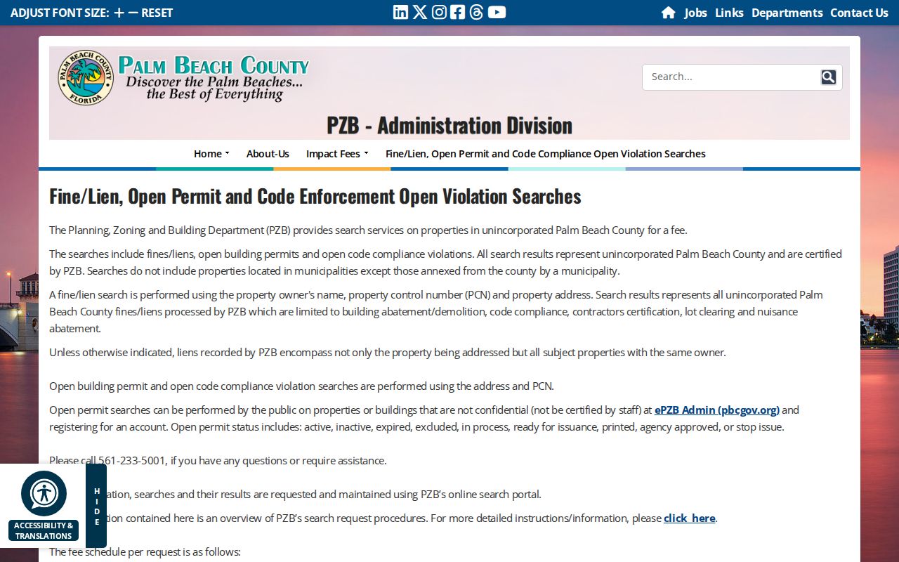
Its separate options make jurisdiction and certification level important before payment.
Note: Permit records document filed activity at a property, not every person who occupied it.
Palm Beach County Street Directory Voter Evidence
The My Status form is not a browseable street roll. It verifies one voter using first name, last name, date of birth, and CAPTCHA. A broader file must be sought through the Supervisor of Elections' records request portal. The office is at 4301 Cherry Road, West Palm Beach, and answers 561-656-6200 weekdays from 8:30 a.m. to 5 p.m.
Florida law generally makes registration and voting history public. Social Security numbers, driver-license or state-ID numbers, and the place of application are confidential. Signatures may be inspected but not copied. Protected voters and preregistered minors receive added protection. Participation history never reveals ballot choices.
PAPA can browse a street or ZIP, while voter self-lookup requires identity details. The two tools do not operate like the same street directory.
Palm Beach County Address Boundaries
ZIP boundaries follow mail delivery, not city limits. West Palm Beach postal areas include Cloud Lake, Glen Ridge, Haverhill, Greenacres edges, and broad unincorporated land. Boca Raton, Boynton Beach, Delray Beach, Lake Worth, and Jupiter postal names also cross municipal lines. Compare ZIP with PAPA's Municipality field before choosing a permit office.
Historic address work needs more care. Postal city, street number, municipal boundary, and subdivision can change on separate schedules. Preserve the PCN, lot, block, subdivision, and legal description. Compare plats and Sanborn maps instead of assuming a modern address existed in the same form.
Palm Beach County Streets in Polk
Documented Main Library R. L. Polk volumes include 1916, 1920, 1925, 1930–31, 1935, 1940, 1944, 1950, 1955, 1960, 1965, 1970, 1975, and 1980–81. This sampled holding is not a continuous run. A reverse section can connect an old number with a named adult or business at publication time.
Ask the library genealogy service about the volume and access method. Ancestry Library Edition is branch-only; HeritageQuest is remote with a valid card. The Palm Beach County city directory collection explains these volumes in depth.
Directories are snapshots, not legal household lists. They may omit children, unlisted people, renters, and anyone missed during compilation.
Palm Beach County Recording Alerts
The Clerk's free Property Fraud Alert monitors new recordings for exact registered matches. It does not block a recording or replace title review. Register useful forms of a name and address because abbreviations and variants matter.
This exact-match quirk matters on long streets. One spelling cannot catch every indexed form. County warnings also note that impostors place real addresses, permit numbers, and official names in false payment messages. Verify demands through a known county channel.
Palm Beach County Street Directory Limits
A roll identifies ownership, not a full household. Deeds prove title interests. Permit files record work. Voter data cover nonexempt registrants, while a city directory captures selected adults and firms at one date. Utility, delivery, and motor-vehicle address data do not become public street lists.
Use two identifiers before deciding records describe the same parcel or person. PCN and legal description beat a shared surname. If online access fails, contact the custodian, use a public terminal, send a mail request, make a Florida Chapter 119 request, or consult the library and archives.
Lawful use. Palm Beach County address records are for lawful personal research. Never use a street directory to stalk, harass, intimidate, or harm anyone.